Preparedness
Response
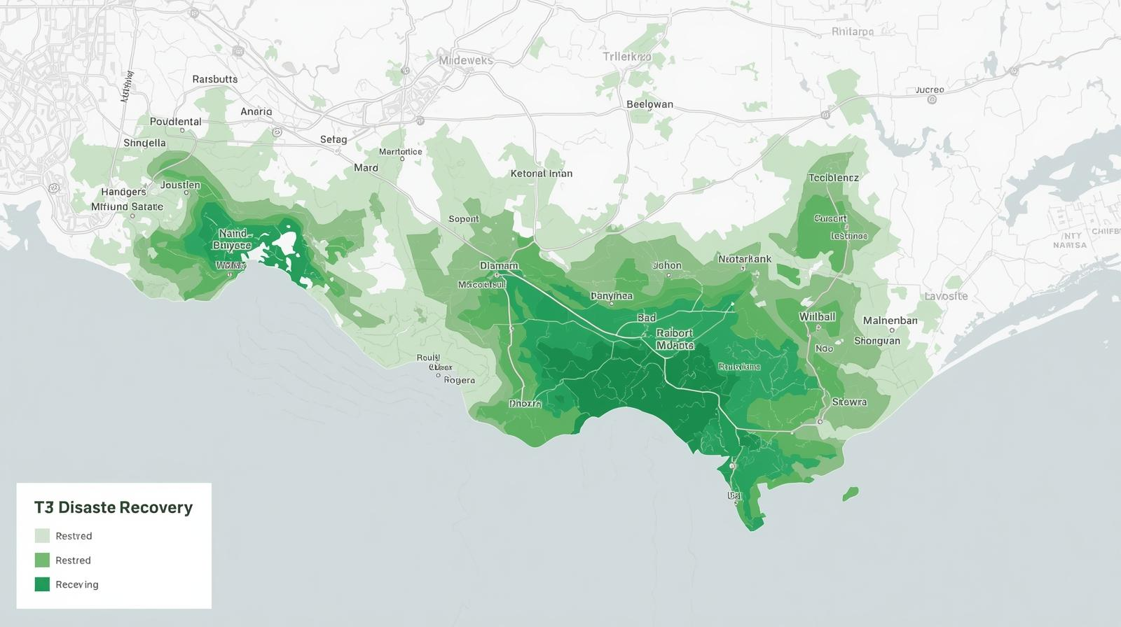
Recovery
Risk Reduction
Communities engage in strategic planning to ensure they are ready to respond effectively to potential disasters
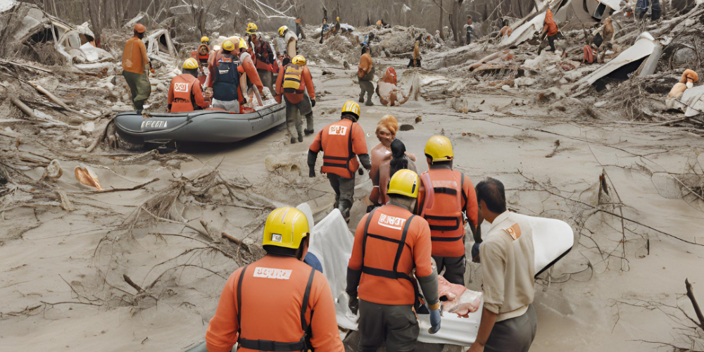
Emergency services mobilize quickly to provide immediate assistance, rescue operations, and relief to those affected by the disaster.
Efforts focus on restoring normalcy through rebuilding infrastructure, providing support to affected communities, and revitalizing the local economy.
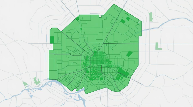
Long-term strategies are implemented to minimize future disaster risks, including conducting vulnerability assessments, detecting environmental and infrastructural changes and strengthening infrastructure.
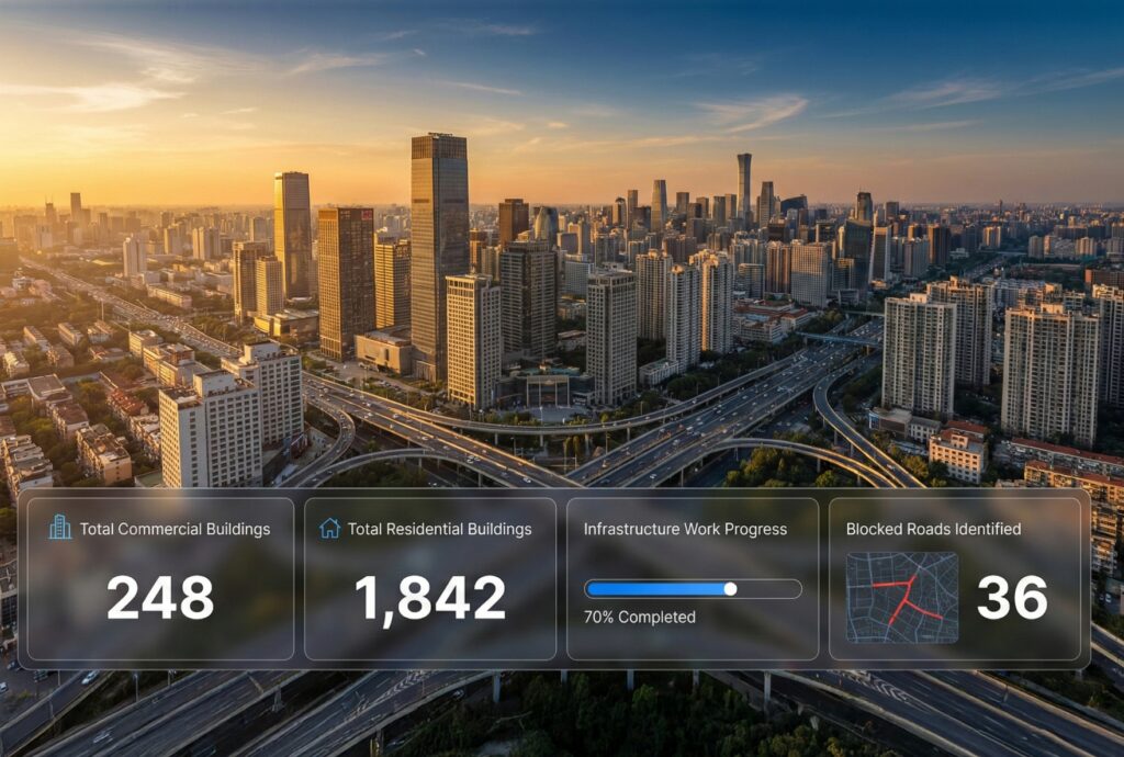
Conduct an inventory of available resources and capabilities to ensure readiness for potential disasters.
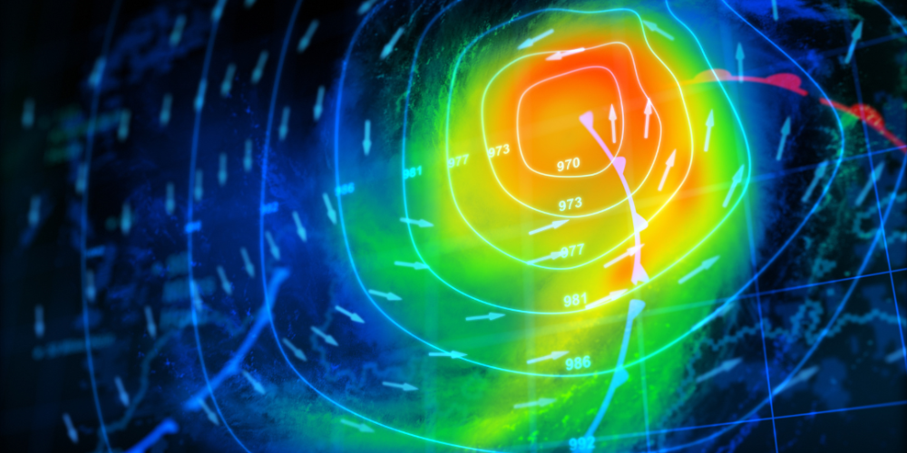
Identify potential hazards and assess their likelihood and impact to develop effective emergency plans.
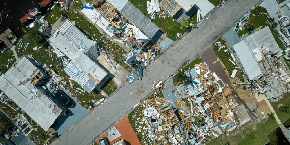
Post-disaster debris identification using advanced detection methods
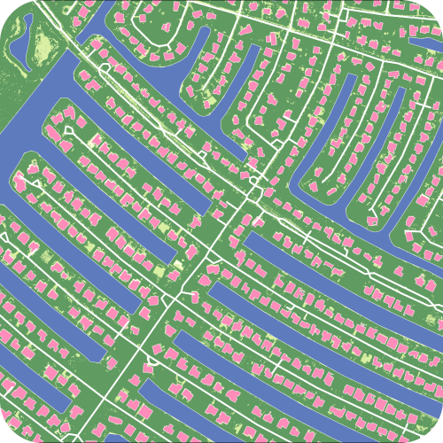
Utilize human detection technology to locate survivors and aid rescue efforts
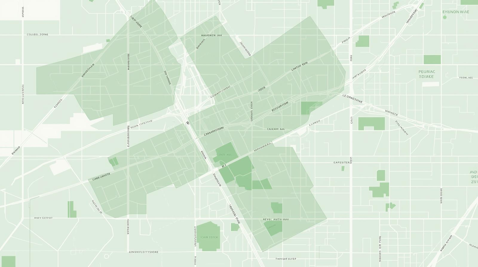
Identify highly impacted areas and prioritize resource allocation for emergency response.

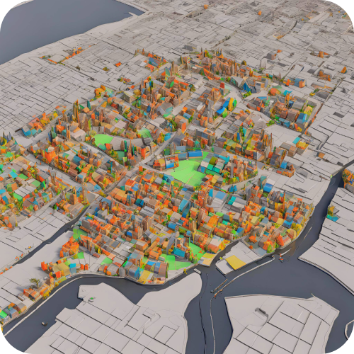
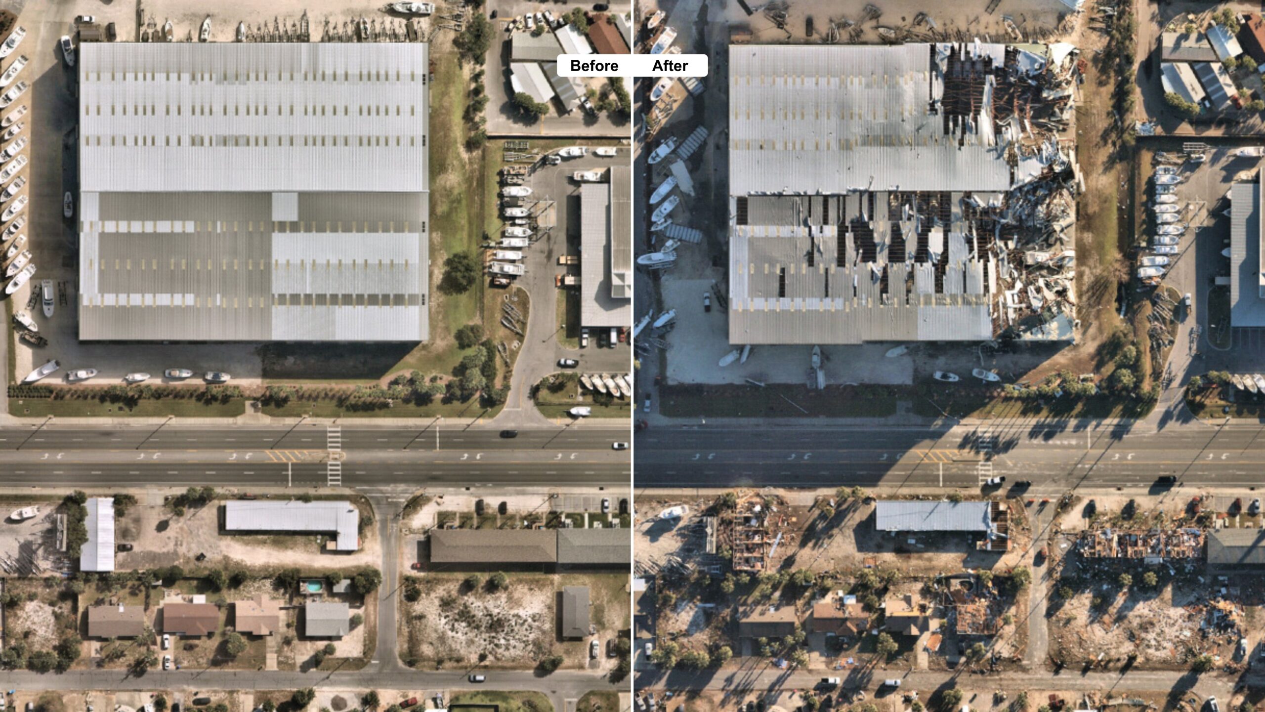
Conduct damage assessments to evaluate the extent of destruction
Assess the needs of affected communities to prioritize recovery efforts and allocate resources effectively.

Change detection for disaster-affected area for timely recovery
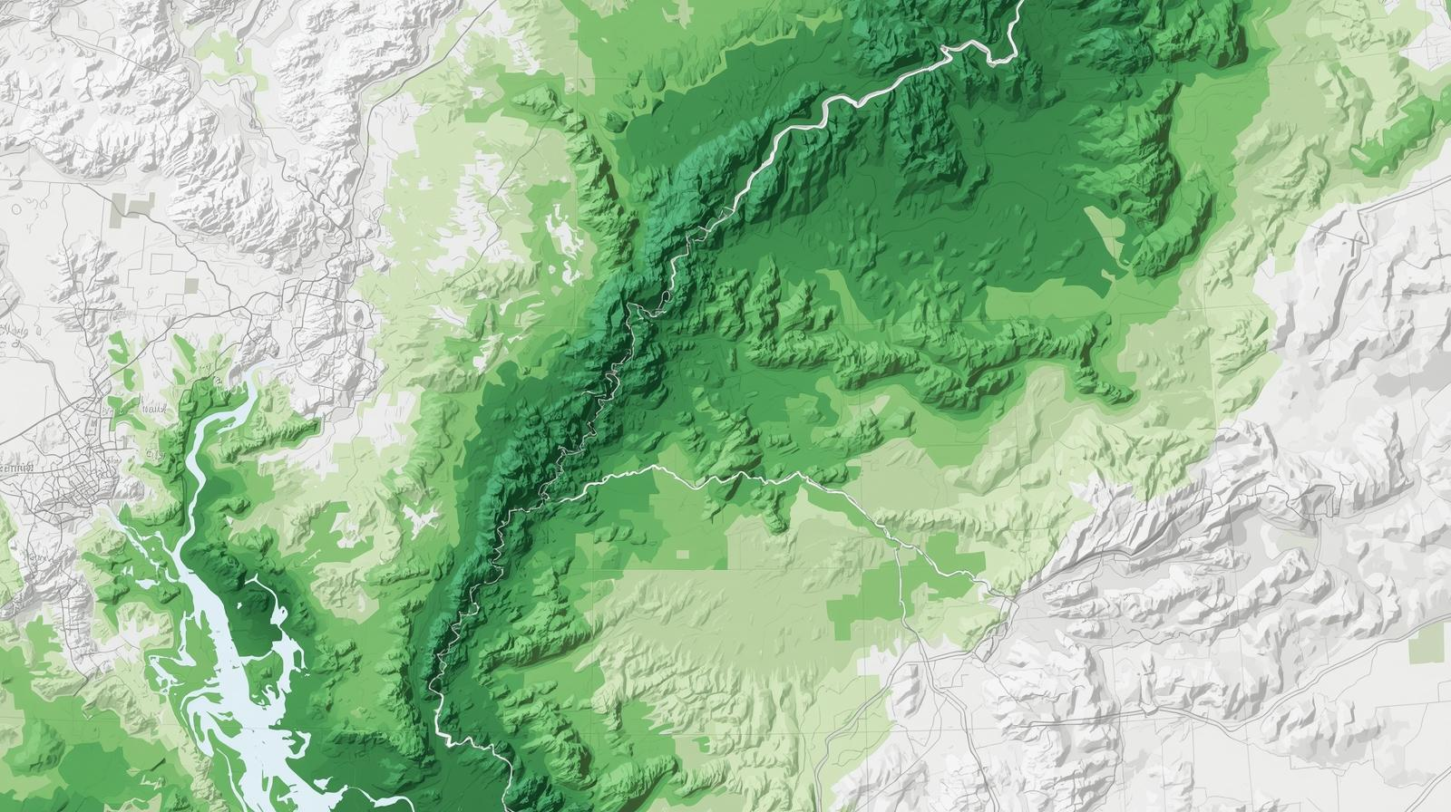
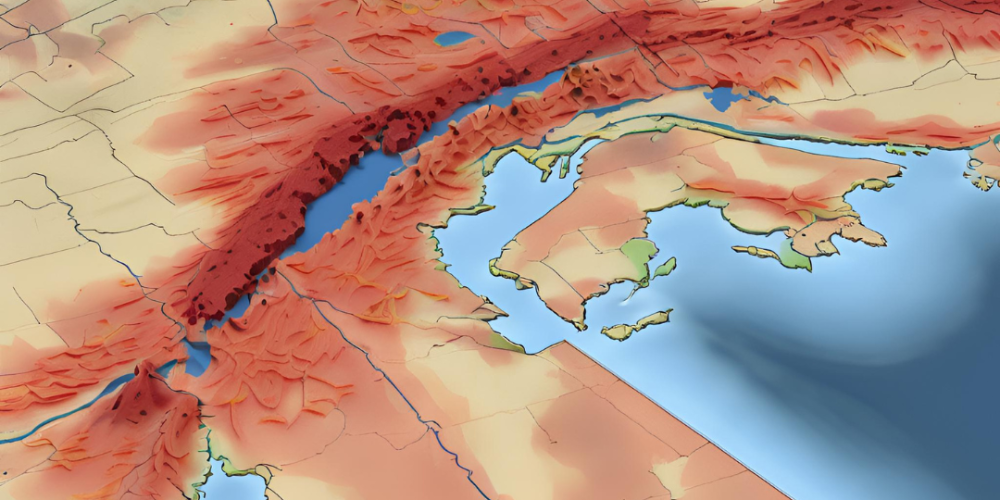
Assess vulnerability of infrastructure and communities to enhance preparedness

Preparedness
Response
Recovery
Risk Reduction
Communities engage in strategic planning to ensure they are ready to respond effectively to potential disasters.
Emergency services mobilize quickly to provide immediate assistance, rescue operations, and relief to those affected by the disaster.
Efforts focus on restoring normalcy through rebuilding infrastructure, providing support to affected communities, and revitalizing the local economy
Long-term strategies are implemented to minimize future disaster risks, including conducting vulnerability assessments, detecting environmental and infrastructural changes and strengthening infrastructure.
Conduct an inventory of available resources and capabilities to ensure readiness for potential disasters.

Identify potential hazards and assess their likelihood and impact to develop effective emergency plans.
Post-disaster debris identification using advanced detection methods
Utilize human detection technology to locate survivors and aid rescue efforts
Identify highly impacted areas and prioritize resource allocation for emergency response.
Conduct damage assessments to evaluate the extent of destruction
Assess the needs of affected communities to prioritize recovery efforts and allocate resources effectively.
Change detection for disaster-affected area for timely recovery

Assess vulnerability of infrastructure and communities to enhance preparedness