Preparation
Sowing
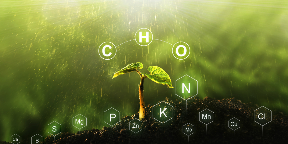
Manuring
Irrigation
Harvest
Farmers prepare the land by plowing, leveling, and incorporating organic matter to create optimal soil conditions for planting
Seeds are carefully planted at the right depth and spacing to ensure proper germination and healthy crop growth.
Organic or inorganic fertilizers are applied to enrich the soil with essential nutrients, promoting robust plant development.
Crops are regularly watered using various irrigation methods to maintain adequate soil moisture for optimal growth.
Mature crops are harvested at the right time to ensure maximum yield and quality, using appropriate techniques and equipment
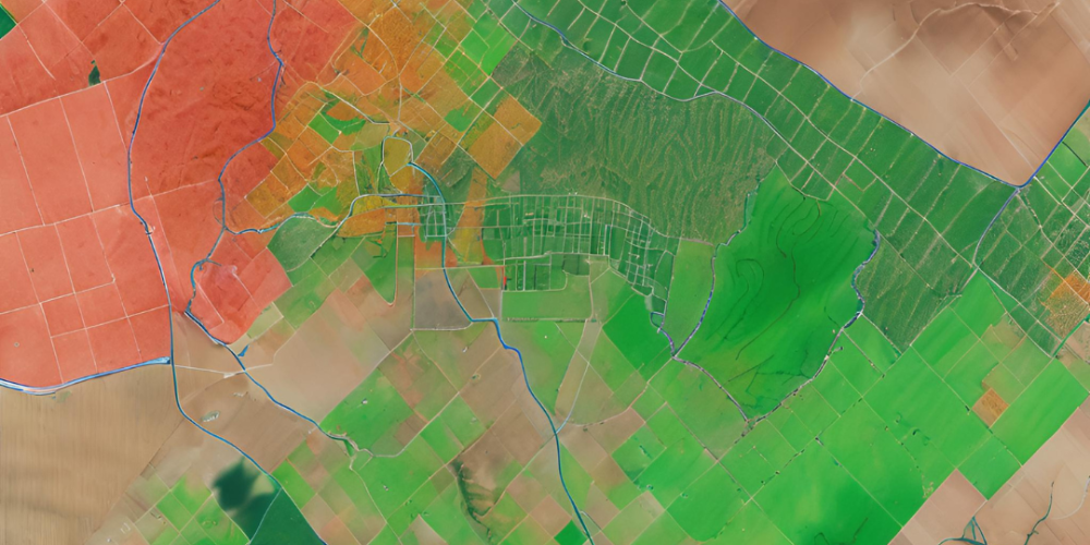
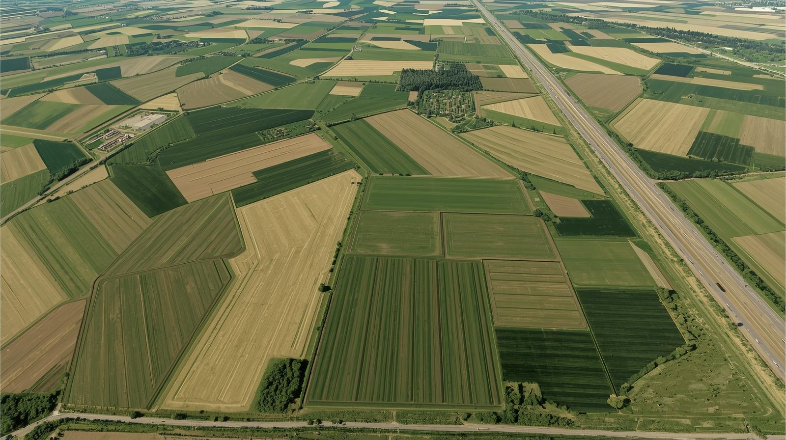
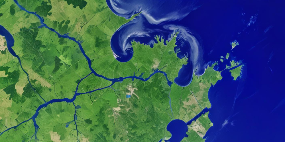
Use spatiosynth to evaluate and map suitable areas for agriculture based on factors such as soil type, climate, and topography.
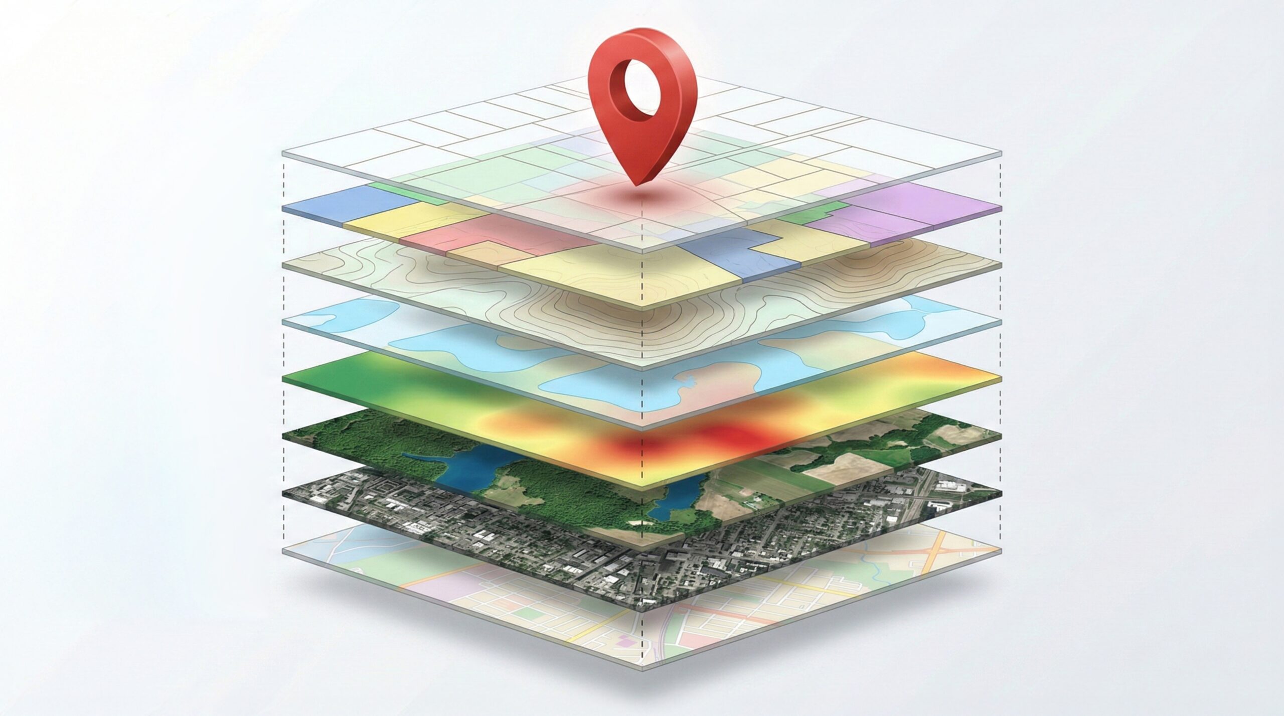
Employ remote sensing and machine learning to assess soil properties like moisture content, nutrient levels, and texture for optimal crop selection.

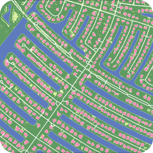
Use Spatiosynth to accurately delineate farm boundaries for efficient land management.

Utilize remote sensing to monitor vegetation health and growth potential, aiding in precise sowing strategies.
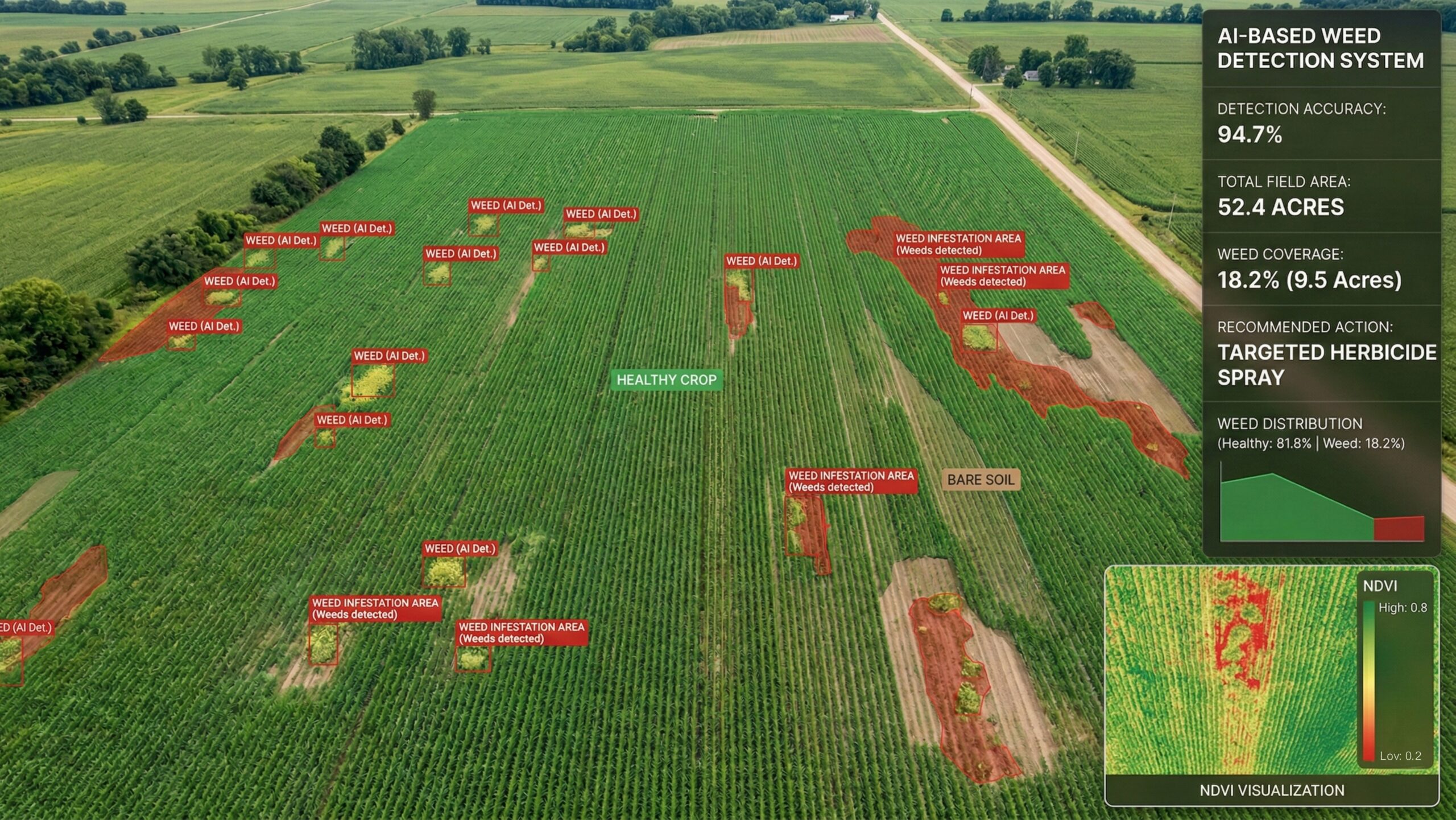
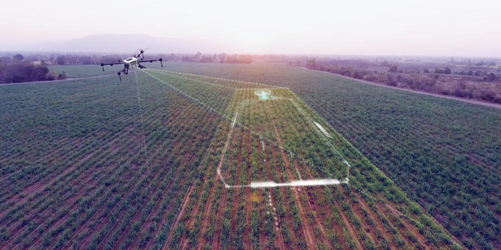
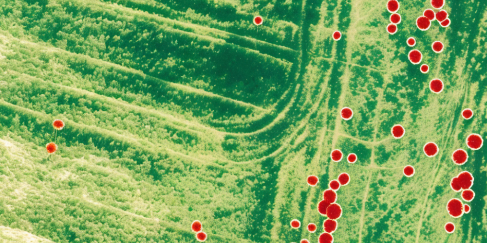
Implement machine learning algorithms on remote sensing data to identify and map weed infestations for targeted weed management.
Apply remote sensing and machine learning to monitor crop health, detecting issues like nutrient deficiencies or disease.
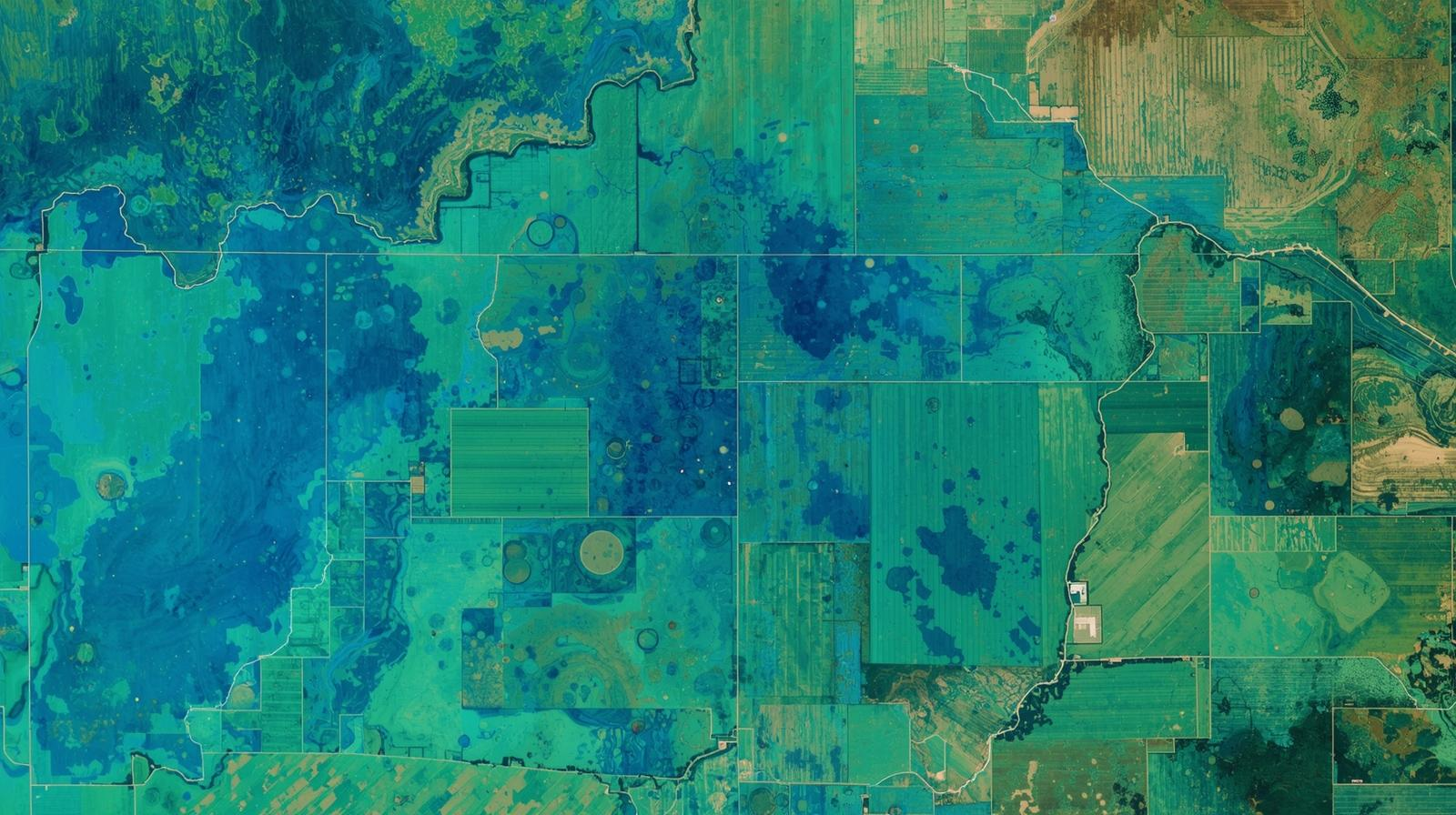
Utilize remote sensing to monitor soil moisture levels and inform precise irrigation scheduling.
Use remote sensing and machine learning to classify and map different crop types within a field.
Employ remote sensing to measure chlorophyll levels in crops, indicating their health and readiness for harvest.
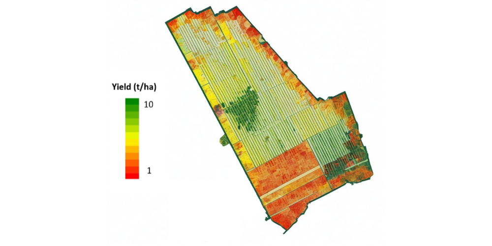
Use machine learning models on remote sensing data to predict crop yields, aiding in harvest planning and market supply forecasts.
Preparation
Sowing
Manuring
Irrigation
Harvest
Farmers prepare the land by plowing, leveling, and incorporating organic matter to create optimal soil conditions for planting.
Seeds are carefully planted at the right depth and spacing to ensure proper germination and healthy crop growth.
Organic or inorganic fertilizers are applied to enrich the soil with essential nutrients, promoting robust plant development.
Crops are regularly watered using various irrigation methods to maintain adequate soil moisture for optimal growth.
Mature crops are harvested at the right time to ensure maximum yield and quality, using appropriate techniques and equipment.
Use spatiosynth to evaluate and map suitable areas for agriculture based on factors such as soil
type, climate, and topography.

Employ remote sensing and machine learning to assess soil properties like moisture content,
nutrient levels, and texture for optimal crop selection.
Use Spatiosynth to accurately delineate farm boundaries for efficient land management.
Utilize remote sensing to monitor vegetation health and growth potential, aiding in precise
sowing strategies.
Implement machine learning algorithms on remote sensing data to identify and map weed
infestations for targeted weed management.
Apply remote sensing and machine learning to monitor crop health, detecting issues like nutrient
deficiencies or disease.
Utilize remote sensing to monitor soil moisture levels and inform precise irrigation scheduling.
Use remote sensing and machine learning to classify and map different crop types within a field.

Employ remote sensing to measure chlorophyll levels in crops, indicating their health and
readiness for harvest.
Use machine learning models on remote sensing data to predict crop yields, aiding in harvest
planning and market supply forecasts.